
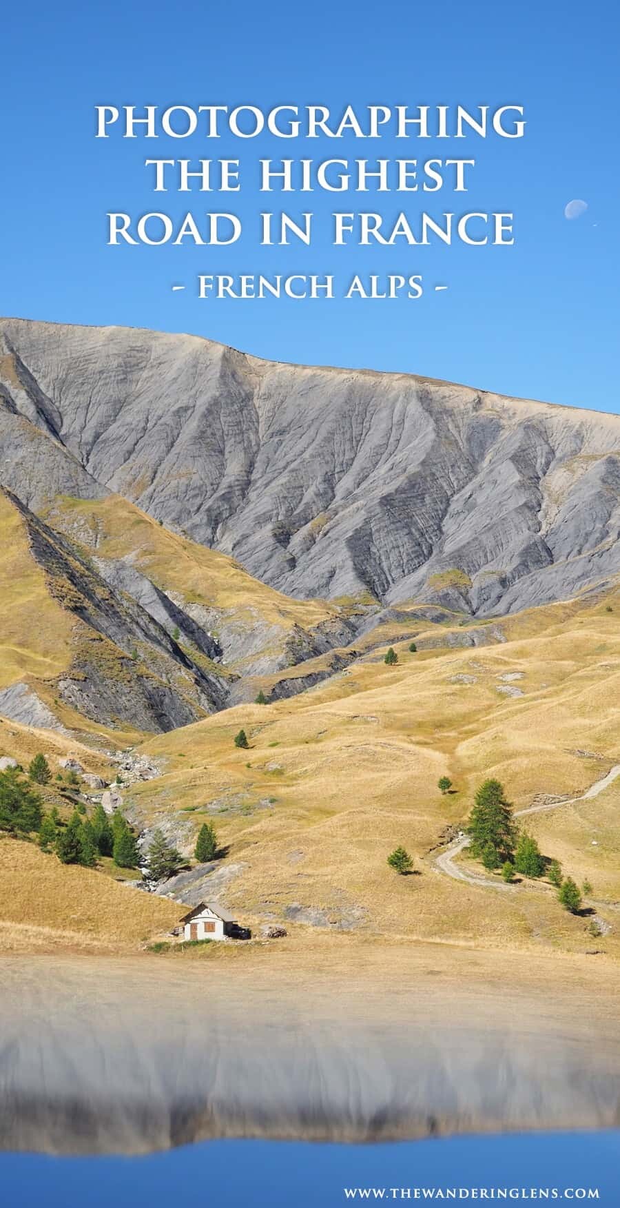
The Col de la Bonette
Coordinates – 44.3216° N, 6.8069° E
I’ll confess, I didn’t actually realise we were driving on the highest paved road in France until we were nearly at the very top.
Our old car was struggling more than usual, a weird puttering and grinding sound started at about 1500m in elevation and mountain peaks were surrounding us in all directions. Concerned about the noises coming from under the bonnet, we decided that if our car was going to have its last drive, it may as well be here, on the Col de la Bonette.
Also, I wanted photos at the top!
Winding its way through the landscapes of Mercantour National Park, The Col de la Bonette runs between Jausiers and Saint-Étienne-de-Tinée in the French Alps. It’s the highest paved road in France and the most accessible in Europe (fourth overall in height) but when judged on whether or not it’s a pass, loop road or dead end, it drops down to the seventh highest in Europe. If however the scenic loop road at the summit was to be included as the Col de la Bonette, it then officially takes the title of the highest road in Europe.
“We decided that if our car was going to have its last drive, it may as well be here, on the Col de la Bonette”
Who knew there were so many technicalities when it came to roads!?
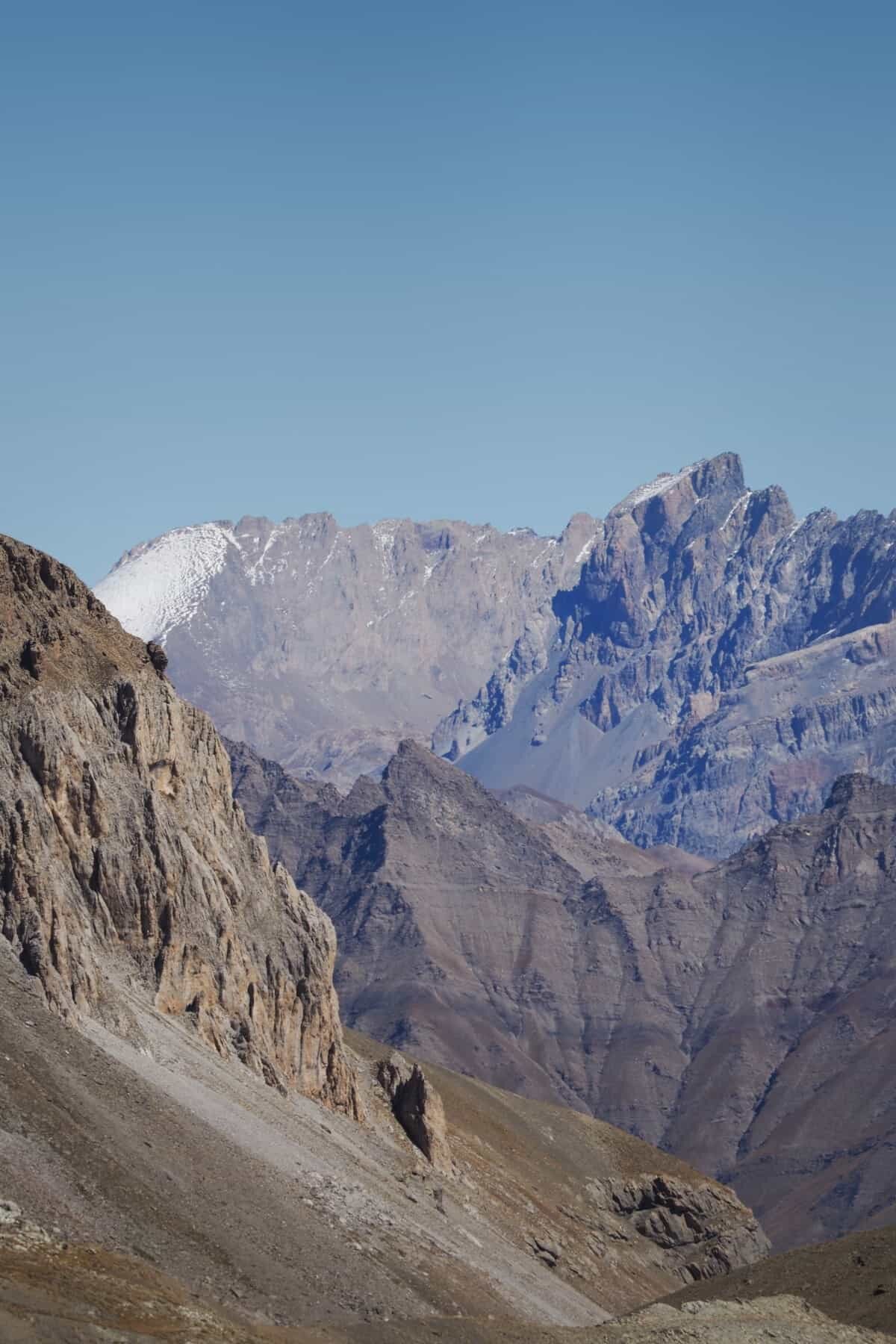
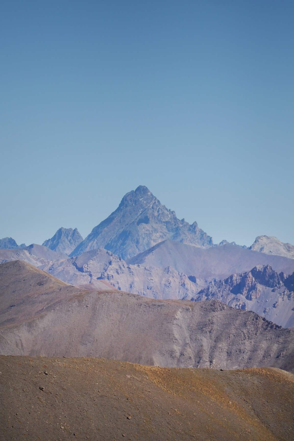
Circling the Cime de la Bonette (Cime meaning summit in French), the road reaches 2,802m at its highest elevation and from the top, peaks on top of peaks are visible in every direction into the distance.
The route is open between May – October and is super popular with cyclists aiming to challenge themselves on the numerous bends and intense maximum gradient of 15%…ouch. In fact, it was the highest point ever reached by the Tour de France when the race passed through in 2008.
You can imagine the look on the cyclists faces when we rock up to the summit with our creaking car, zero respect.
We on the other hand were so damn impressed that people would choose to tackle this crazy road on a bicycle. And not only tackle it, but almost beat our car up the hill! For an amazing insight into what it’s like to cycle this road, check out The Col Collective’s video, such a great summary of the route.
Starting in the small alpine village of Jausiers, the route leads all the way down to Nice if you wish, otherwise right at the top of the Col de la Bonette there’s a loop so you can head back down the same way you drove up.
Now, of course the trip wasn’t all about sitting in a car and driving up and back down again. It was more about photographing the landscapes along the way and stopping at almost every bend because it just kept getting more and more photogenic.
Some photography hot spots on the Col de la Bonette Route are listed below…
Ravin du Pis
Coordinates – 44°22’10.0″N 6°47’04.8″E
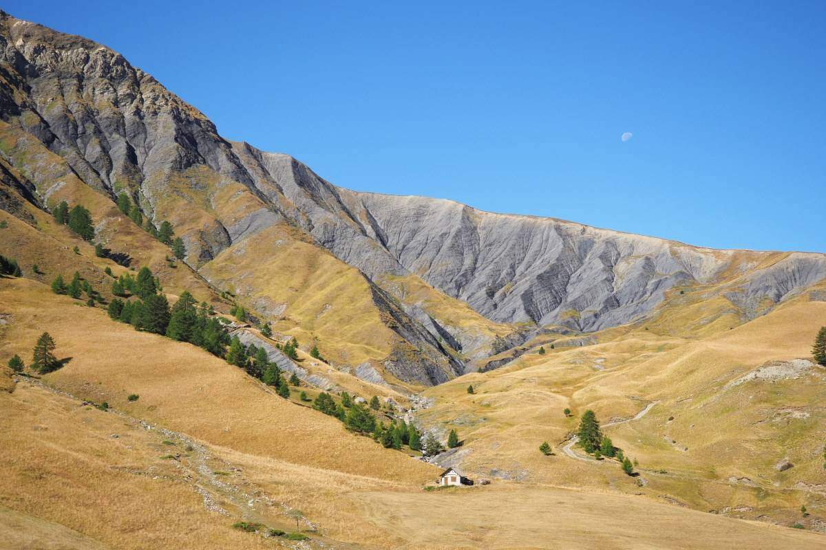
Just up the road from the Restaurant Le Chateau, roughly 25mins uphill from Jausiers, the valley starts to open up providing a great initial photography stop to capture some alpine landscapes.
Once you pass the restaurant you’ll find a small parking bay on the right side of the road and from there you can photography across the valley and Torrent de Clapouse (small rapids). There’s a perfectly located little mountain hut too which is located beneath rugged scenery.
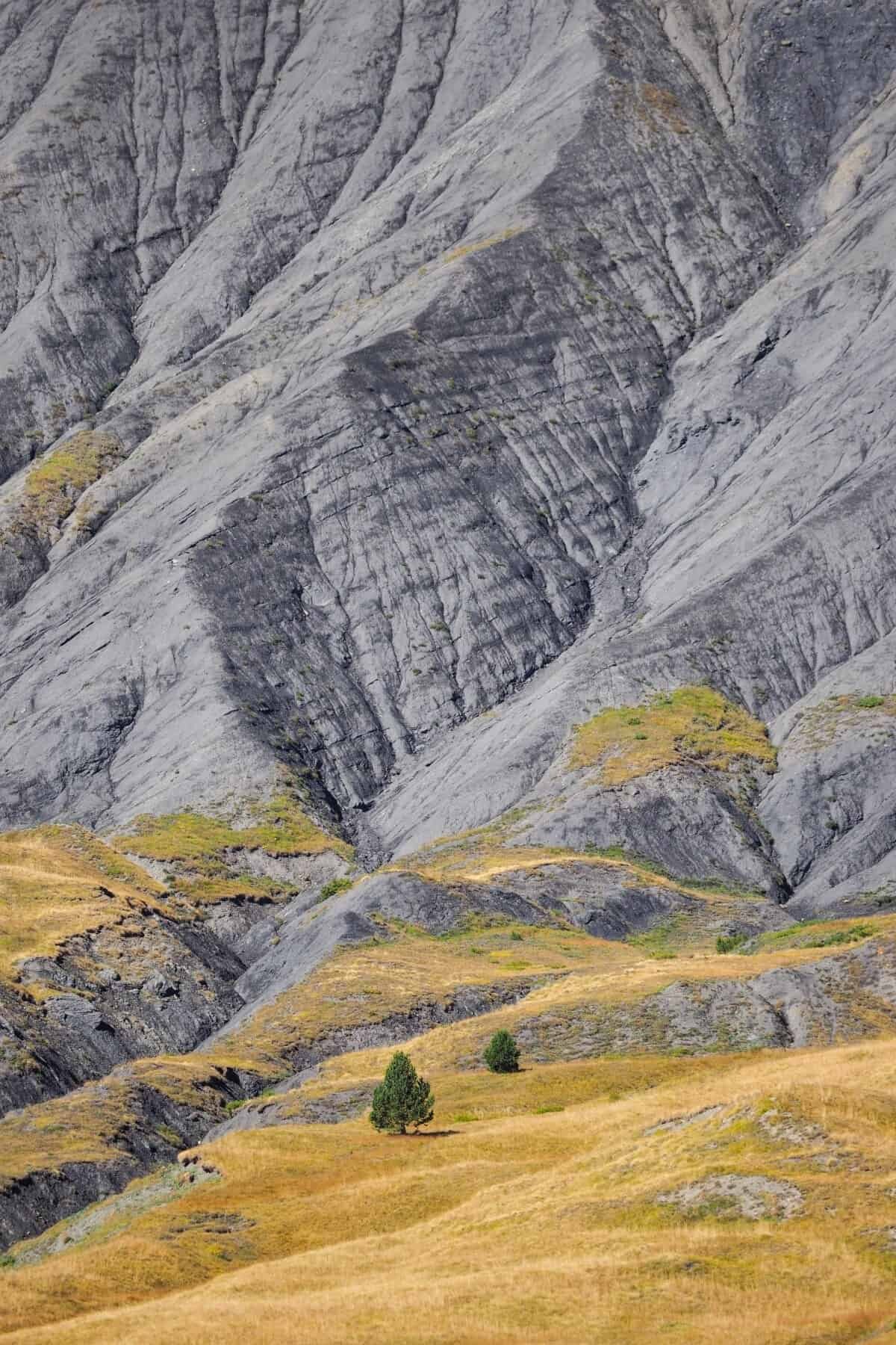
I found this spot ideal for photographing the textures and details within the landscape! Most of my images are taken with the Olympus M.Zuiko 40-150mm f/2.8 PRO lens which enabled me to zoom in nice and close to capture the ridgelines and rocks.
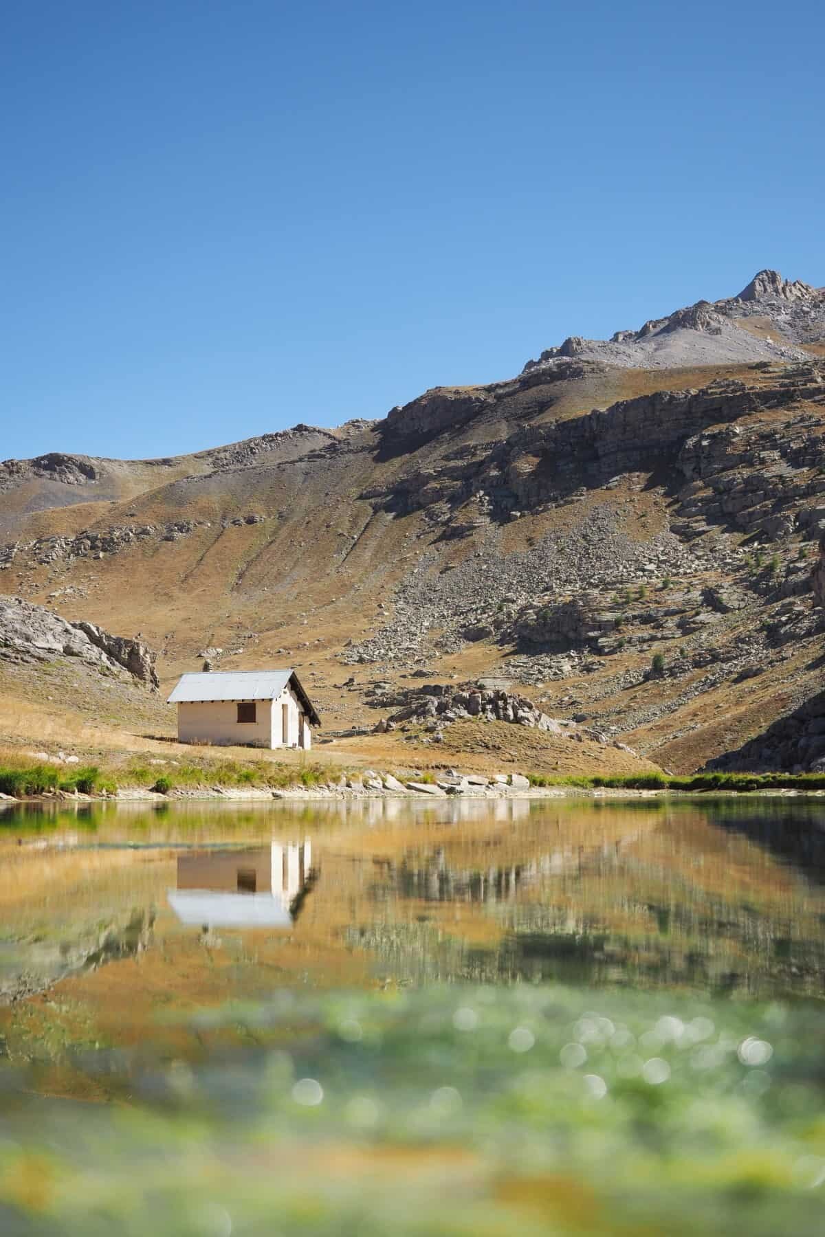
Lac des Eissaupres
Coordinates – 44°20’34.0″N 6°46’59.2″E
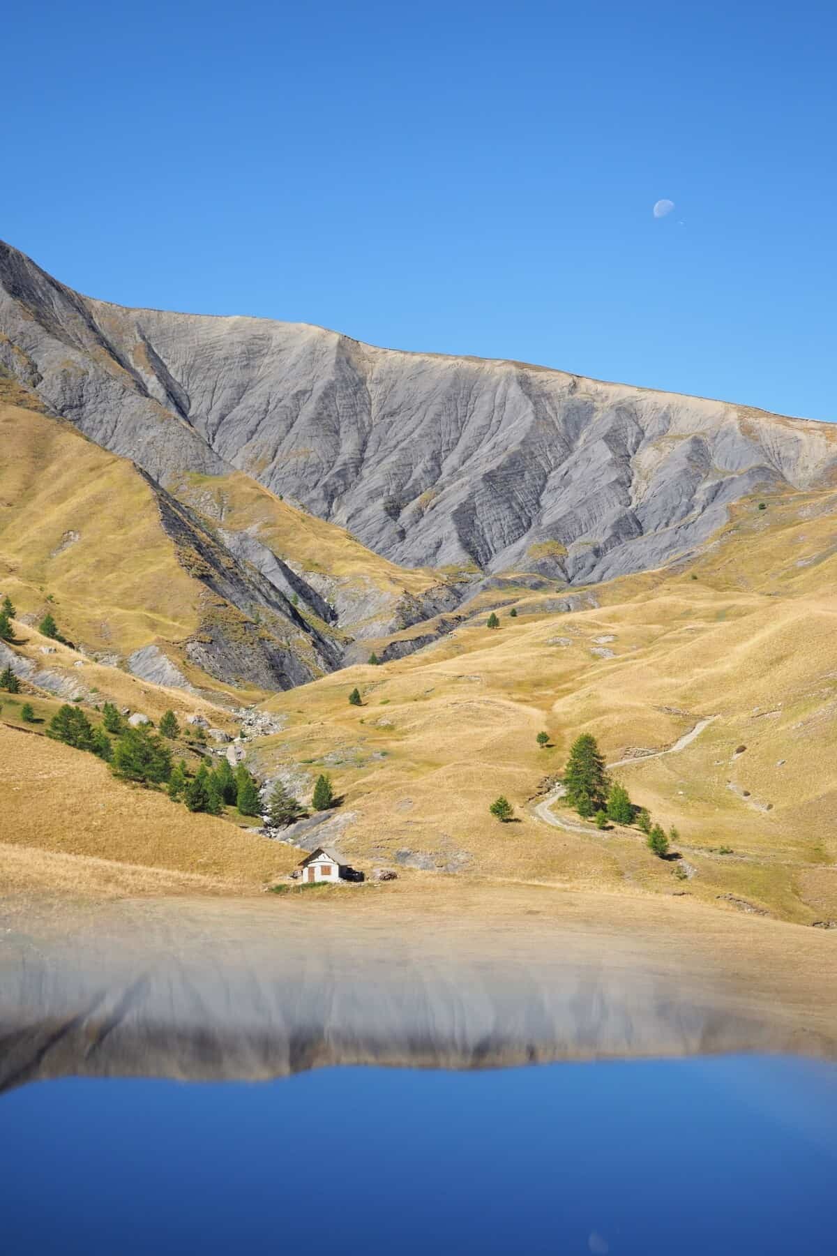
Located about 20minutes from the summit, this lake rests in a small valley with mountains rising up in all directions. It’s a great place to stop and get a good dose of fresh air while having a wander around the water’s edge with your camera.
Just beside the parking area there’s a little mountain hut that works really well in photos. Take a walk around the lake to capture it from the best angle with the water in the foreground. Oh and if you’re reflection mad like me, on a calm day this place is reflecting everywhere you look!
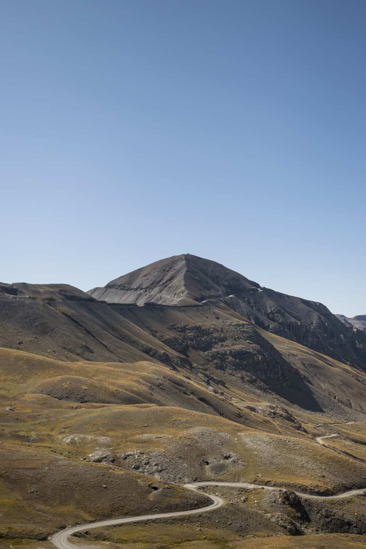
Faux col de Restefond
Coordinates – 44°20’12.2″N 6°48’04.5″E
This is where you’ll get your first glimpse of the Cime de la Bonette once you turn a bend and see the landscape reveal itself before you.
Prior to this bend the road weaves around through valleys and between ridges, from the Faux Col de Restefond onward though, you’re sky high!
It’s tricky to stop and pull the car over but if you’re not the one driving, hang out the window and get snap happy. Alternatively if you’re one of those brave souls on a bicycle, I’d say this is another good place to stop and rest your legs which would surely be numb by now. The previous statement is based on zero experience ha!
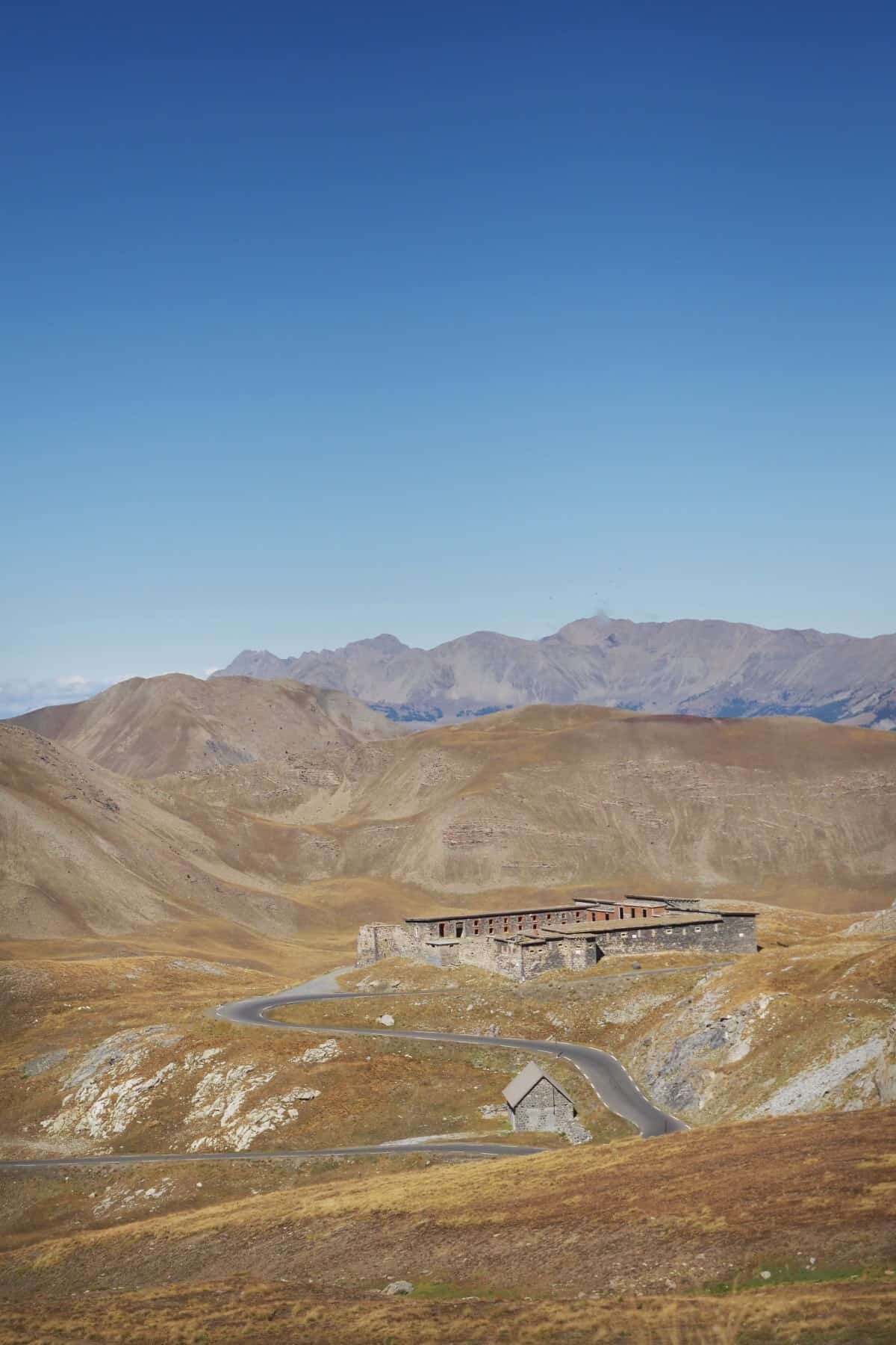
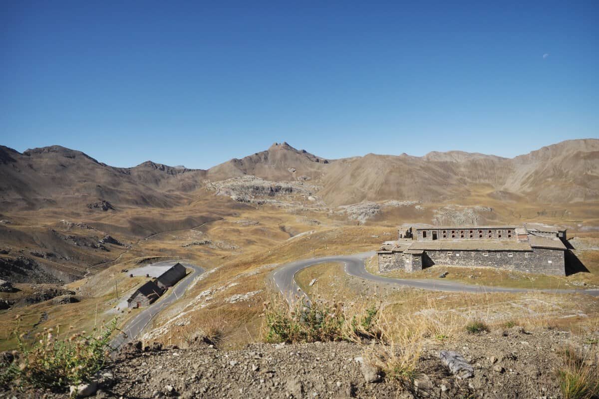
Fortin du Restefond
Coordinates – 44°20’38.7″N 6°47’49.7″E
Used as a base during the Battle of the Alps in 1940, these stone military barracks blend with the surrounding rugged scenery.
Comprising of four buildings, not all of which are currently standing, the fort was used by the French military since 1901 and even until recently was a base for the Mountain Combat Training Centre.
From this stop you can capture the fort within the landscape but also because the location is at 2,558m in elevation, the scenery is barren and incredible. It’s a great spot to capture a section of the Col de la Bonette as it winds back down toward Jausiers too.
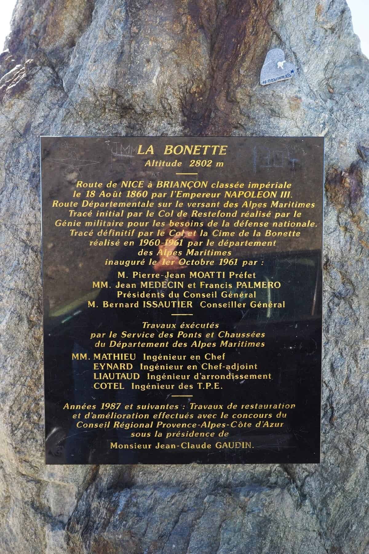
Cime de la Bonette
Coordinates – 44.3216° N, 6.8069° E
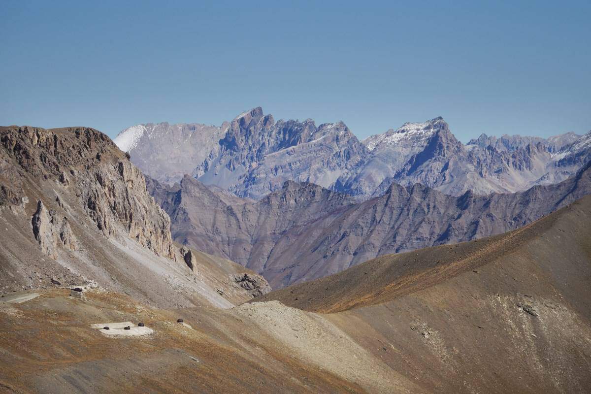
Of course, the summit provides the best vantage point on the route and it’s nothing short of spectacular. With views across the Alpes-De-Haute-Provence and Alpes-Maritimes, you’re actually standing right on the border of both departments which intersect at the summit.
To officially reach the summit, you’ll need to park the car and walk the last tiny bit to the top but really, if you’ve sat in the car the entire trip up, the last 5minute climb is nothing. If you’ve cycled, I’ll completely understand if you skip the walk!
While at the top, be sure to look at the landscapes in every direction as the light will cast shadows and tones across the scenery in different ways. Italy is visible in the east and the dark rocks make for great foreground subjects as you capture the incredible views.
Where to Stay in the Jausiers Region
There’s nowhere to stay at the top, or even near the top, however, you can base yourself where the road begins in Jausiers!
There’s a number of hotels, guesthouses and cabins to choose from in Jausiers as it’s a popular place for people visiting to hike, go white water rafting or of course cycle throughout the region.
Nearby Barcelonnette is another option with more restaurants and a general lively vibe in comparison. It’s just an extra few minutes drive away so it comes down to personal preference.
To view a collection of places to stay in Jausiers take a peek at a list here.
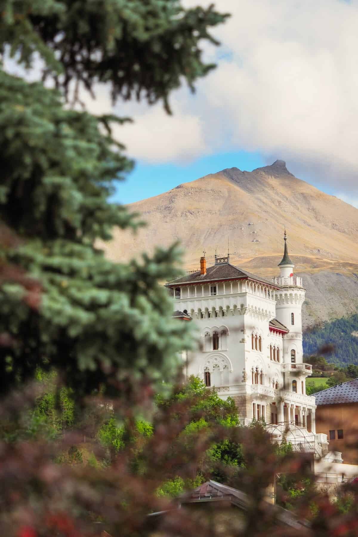
Otherwise, we stayed at Cinderella’s Castle. Just kidding, but really, check out the photo below, it’s pretty Disney inspired no!?
Résidence Château des Magnans by Popinns – located amongst the forested foothills of the alps at the start of the Col de la Bonette, this hotel is stunning and surprisingly, really affordable. You can opt to stay in the castle or just beside there’s a less fairytale-like building with standard apartments, ideal for groups, families or couples.
The views from this hotel are absolutely beautiful looking down into the Ubaye Valley, oh and there’s even an indoor pool!
For the Pinterest lovers –
Hello! I’m the founder and photographer behind The Wandering Lens.
With 19+yrs experience as a professional travel and landscape photographer, all advice found on this site is from my personal experience, or that of contributors, on the road. I hope it’s useful for your own travels and would love to hear in the comments about your trips and experiences around the world.
Leave a Comment